The Enigmatic Scud Cloud
A scud cloud is ephemeral if nothing else. It is low-flying, fast-moving, and rapidly transforming under the larger clouds that bring them into being and them send them back again. The three traits that distinguish a scud clouds are their low altitude, the speed with which they move, and their ragged-edged appearance. But beyond that optimistically bold trait allocation, there is an awful lot of disagreement scudding around the internet about what is and is not a scud cloud. Poking around for scud clarification can at times heat things enough to convect into a bit of turbulence if you aren’t watchful. So buckle up kids, this ride might get a little hairy.

This profusion of confusion is typical for phenomena beloved by so many amateurs, afficionados, buffs, mavens, neophytes, and /or enthusiasts (myself included), but which are explained by complicated physical and meteorological dynamics, and classified according to subtly nuanced, sometimes overlapping, and always shifting characteristics. I myself, having admired them for many a moon, am still not entirely sure if I’m looking at a particularly hard-hit cumulus fractus or just a chunky stratus fractus, especially when it comes to photo IDs.
In this fine article, we heroically set about disambiguating the noble scud from the ethereal fog of the unknown and unnamed. In true Enlightened fasheen we aim to shine the bright light of clarifying knowledge on the enigmatic and elusive scud. We give it form by squaring it alongside it’s cousins, and substance by elucidating causation and consequence. By the time you’ve finished reading (total read time: 8 minutes), you’ll know scuds from suds and any other type of clouds, you’ll be able to put a scud in its place, and most importantly, you be able to reassure everyone running for storm cellars at the sight of a scud, or screaming that the Ende is Nigh, they are most likely are safe from both. So, without further bombast or ado:
What is A Scud Cloud?
Scud Cloud Classification
Classification-wise, a scud cloud is either or both of two types of the cloud species Fractus (Latin for “broken”); stratus fractus and fractus cumulus. Stratus fractus and fractus cumulus can appear individually, or in combination, or in combination with others. They can appear in dry, and/or stable, and/or wet, and/or turbulent weather. Stratus fractus in wet weather always occur in conjunction with clouds of other genera. Fractus cumulus in wet weather also always occur in combination with clouds of other genera. Fractus clouds of either two types, singly or in combination, in wet weather, combine to form Pannus, an accessory cloud (an accessory cloud is dependent upon another larger cloud, and so proximate to it, but not necessarily attached to it). (Stratus fractus and fractus cumulus, because they can occur and remain alone, are not accessory clouds).
If I were to come entirely clean, I would have to confess that this is a point on which I’m still a bit foggy: how can two clouds in combination be classified as a third type of cloud while still remaining distinct as their two originary types. But if it’s good enough for the World Meteorological Organization, then by gum it’s good enough for me.
Scud Cloud Etymology
My first thought, when I learned of the phenomenon of scud clouds, was of the homonymous Scud Missile, developed by the Soviets and used by Iraq in the 1991 Persian Gulf War. NATO dubbed it such, perhaps because it sure could scud (“move quickly and without stopping in a straight line”). My second thought was of how it has become a bit of a literary cliche to describe clouds as “scudding” across the sky. But what I hadn’t been aware of until that moment was that scud was a type of cloud. And just to add to the swirling mist and scud of proliferating meanings, scud also happens to refer to the actual shower of rain or snow blown by wind. So where did this popular name for fractus clouds come from?
The source, alas, is unclear. The most likely explanation, if you ask me, is that they’re called scud clouds because they scud. However, there are some who believe scud is an acronym for StratoCumulus Under Deck, referring to the frequency of stratocumulus as the cloud which scud clouds accessorize on the underside. But this smacks of apocrapha to me, especially considering that fractus often form beneath the base of lowering Altostratus or Nimbostratus, and that pannus, the most papparazzi’d of the scuds, love cumulonimbus more than any other mother.
It would relieve me greatly if I could clear up this fractus fracas, and nail down the source of the common name for fractus and pannus, whichever way the wind happens to blow.
Three Types of Scud Cloud & How They Form
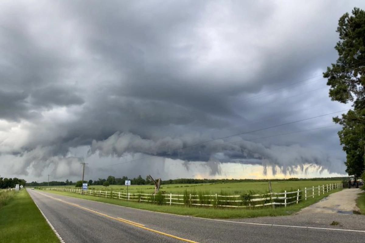
There are three main types of scud cloud: cumulus fractus, fractus stratus; and the two combined to form pannus. All three are ragged-edged, low-flying, and fast-moving. Pannus clouds are accessory clouds, found near and dependent upon larger, slower-moving nimbus or cumulonimbus clouds to form. Pannus are caused by (and so are a sign of) atmospheric turbulence and/or convective processes that can lead to severe weather.
Cumulus Fractus
Cumulus fractus clouds often result from the breaking up or dissipation of larger clouds. When a cumulus cloud, for example, starts to lose its structure, smaller fragments or shreds may remain, forming cumulus fractus clouds. Generally dissipation or turbulence is the cause of the largers clouds’ fragmenting.
Fractus Stratus
Fractus stratus are typically formed when a stable layer of Stratus clouds is broken up by the intrusion of turbulent air currents, or due to the action of localized atmospheric action and/or terrain effects.
Pannus Clouds
Pannus clouds are the most dynamic of the three. They’re formed by the convection of storms, either in downdrafts at the front of a storm, or in updrafts at the rear. In updrafts, cooler air falling at the front of a storm is pulled into the storm by warm air rising in the updraft and recondensed; in downdrafts, as cool moist air is lifted from the ground by the warmer moister updraft in the back of a storm, condensed, and pushed forward to the front of the storm.
Pannus formed in an updraft have a more compact cycle, and can sometimes form into wall clouds which can then sometimes spawn funnel clouds. Pannus formed in downdrafts tend to be ejected from the turbulence of a storm by a process known as detrainment.
What Do Scud Clouds Look Like?
Scud clouds are fast-moving, low-level (usually based less than 1,500 feet above ground) clouds characterized by a ragged and irregular appearance of varying intensities. These clouds typically manifest beneath larger convective cloud systems, such as cumulonimbus clouds, and are indicative of turbulent atmospheric conditions. Scud clouds form due to the updrafts and downdrafts within a convective cloud, leading to the formation of fragmented cloud elements at the cloud base. They often appear wispy, with irregular shapes and varying heights.
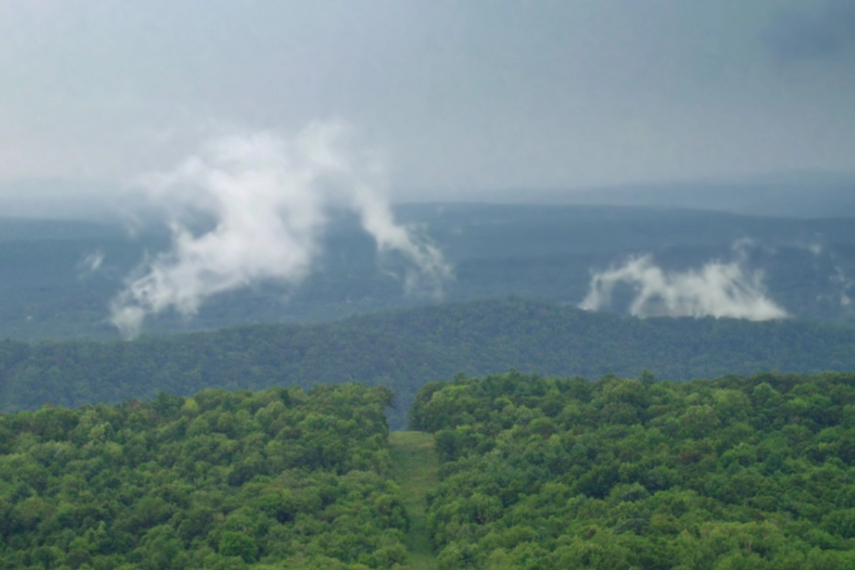
Cumulus Fractus


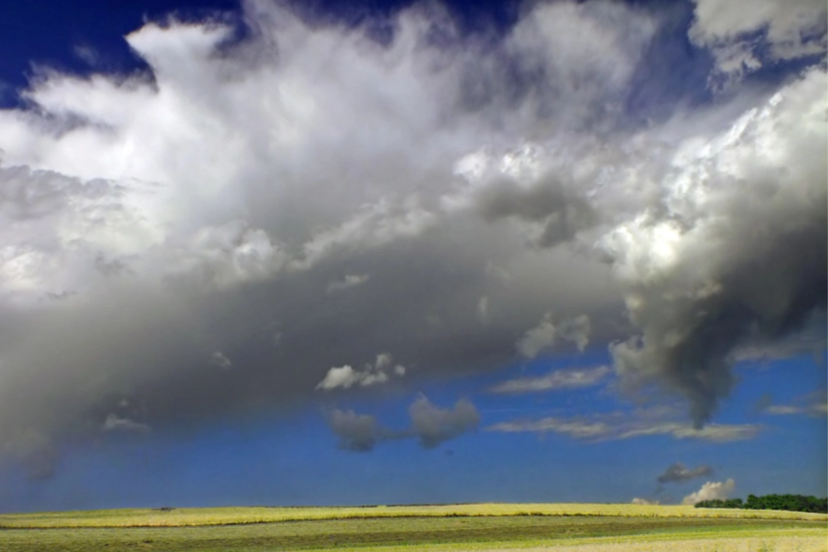
The three images above are cumulus fractus (Latin: “broken heap”). The two on the left are dry weather clouds. The image on the right is wet weather. Wet weather cumulus fractus are are broken, ragged cumulus clouds. Cumulus fractus resemble cotton balls that have been stretched and pulled in several directions, but retain the recognizable lump form. can vary widely in size and shape. They are, and are sighted during unsettled weather, such as before or after a storm.
Wet Weather Cumulus fractus: in wet weather they’re darker in contrast to the clouds around them, though not by much, and typically accompanied by precipitation. Dry weather cumulus fractus generally appear alone without other kinds of clouds and tend to scud across the sky isolated from one another by plenty of space. They are typically bright white, stand out well without a backdrop of other clouds, and look like shredded balls of cotton. Both wet and dry move quickly and shift and break apart rapildy as they’re batted about by powerful winds.
Stratus Fractus

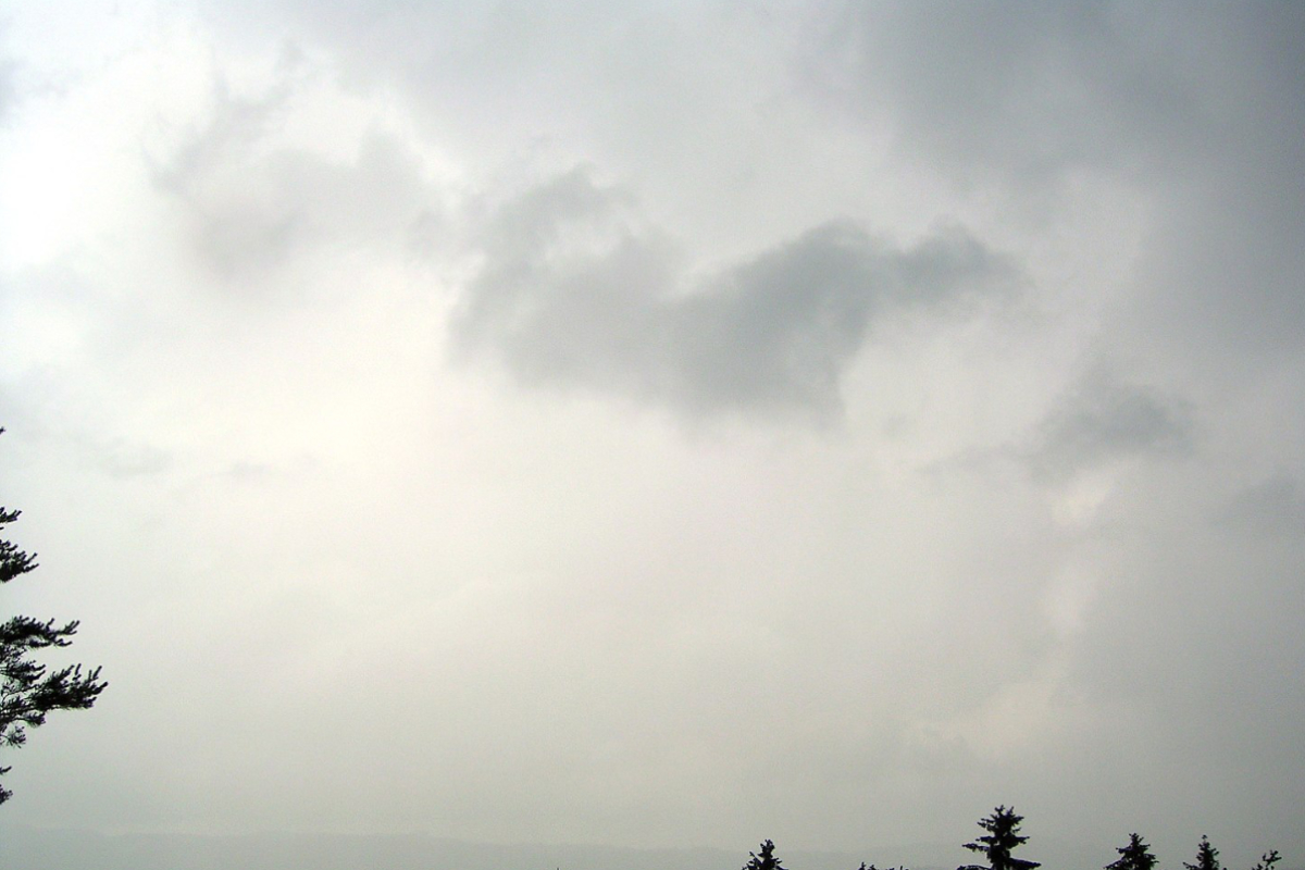

These three images are of Stratus fractus (Latin = “ragged layer”). The first two are of wet weather stratus fractus. The third image is in dry weather. Stratus fractus are broken, ragged stratocumulus clouds, characterized by their wispy, dark appearance, resulting from greater dispersion of their moisture particles. They’re typically found in the form of thin, low-lying layers or as irregularly shaped clumps or fragments, and resemble cotton balls that have been stretched so far in so many directions that they are unrecognizable from the original.
Fractus Stratus wet weather: usually accompanied by precipitation, generally gray with the sun behind them and white against the backdrop of other clouds, especially storm clouds. In dry weather, fractus stratus appear similar to their dry weather counterparts, but much less distinct against the backdrop of other clouds, without the precipitation.
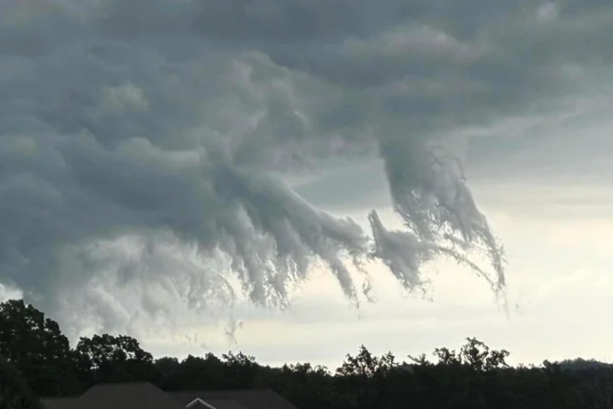
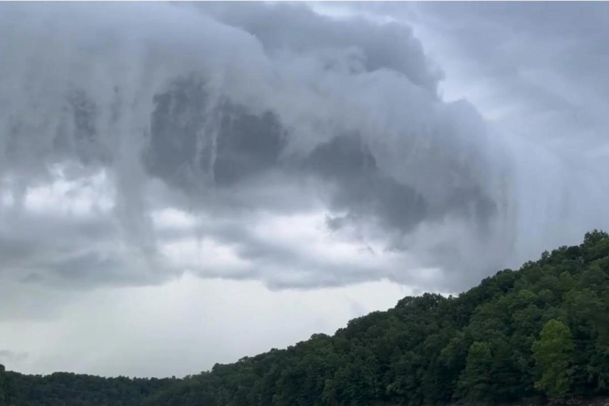
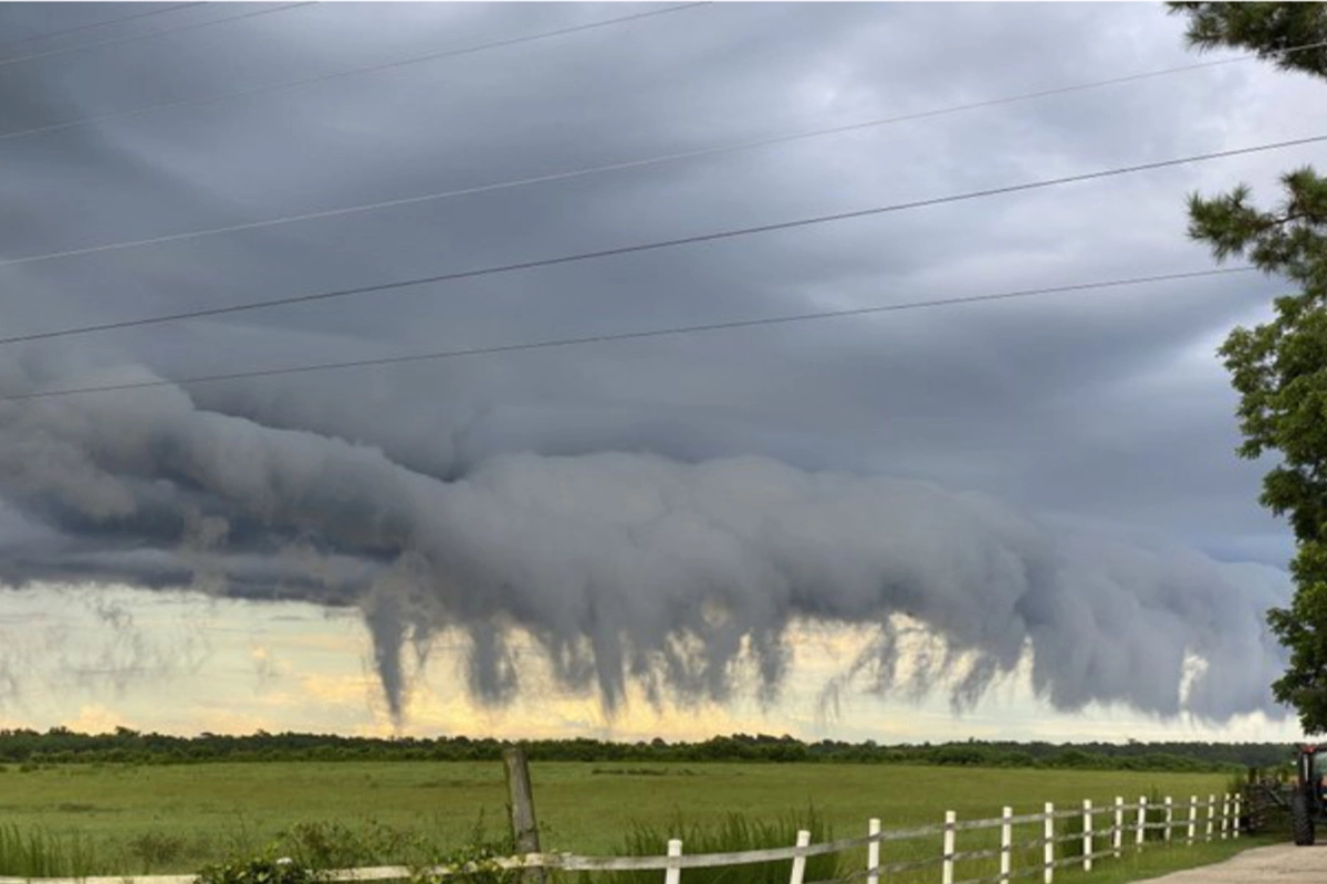
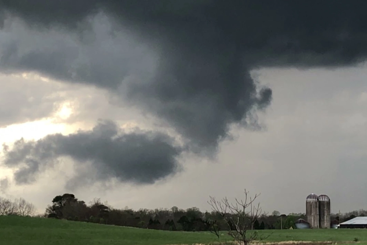
Pannus Clouds

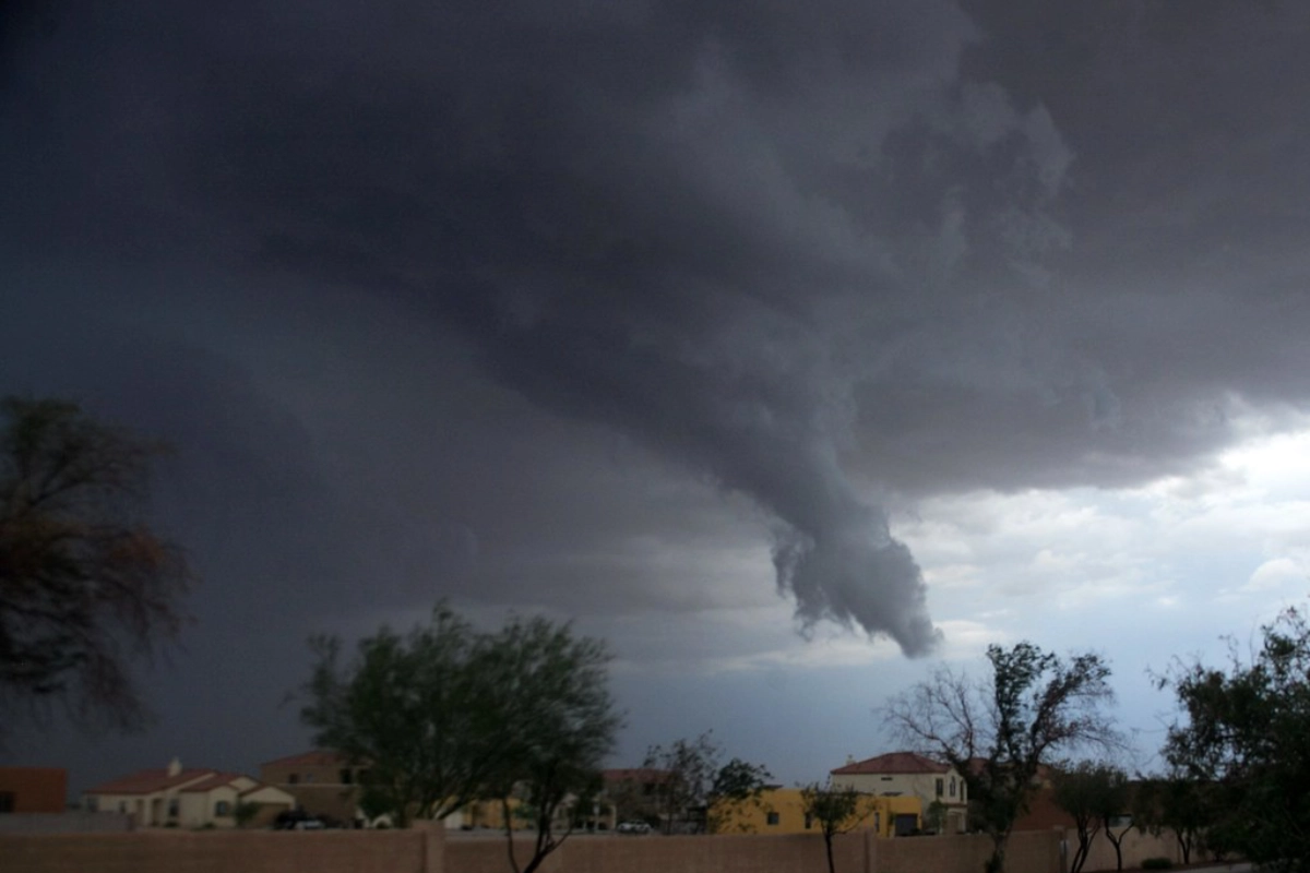

Pannus clouds are the broody, sullen, oh-so-misunderstood, curtain-of-wet-hair-over-the-eyes teenagers of the meteorological world. Pannus (Greek for “shred”) is the much less common and much more distinct and visually dramatic type of scud cloud, though the likeliest the be fingered for scud in a line-up.
It’s these attention-seeking but ultimately harmless moody teenagers that tend to produce the warped cones that look suspiciously tornado-like but are in fact yanked not twisted, lacking the characteristic spin of a funnel. Or they produce the ragged dendrils that look like a god’s claws raking across the landscape almost as quickly as they spread virally across social media. They are neither a tornado nor a sign of the end times; they are merely fast-moving air, sloppy with moisture, putting on a good show as they’re knocked about by larger more powerful forces. If that doesn’t sound like adolescence I don’t know what does.
Conclusion
Scud clouds are the mysterious, captivating, ephemeral creatures of the sky, characterized by low altitude, high speed, and ragged-edged appearance. The complexity of the atmospheric dynamics involved in the formation and transformation of scud clouds make them especially tough to nail down. But we’re tougher, and made a significant contribution to the online elucidation and of the enigmatic scud if I do say so myself.
Frequently Asked Questions
A scud cloud is characterized by being low-flying, fast-moving, and exhibiting a rapid transformation under larger clouds.
Scud clouds fall into the cloud species Fractus, specifically stratus fractus and fractus cumulus. They can appear individually or in combination, in various weather conditions.
Yes, scud clouds, especially pannus clouds, are indicative of atmospheric turbulence and convective processes that can lead to severe weather.
There are three main types: cumulus fractus, fractus stratus, and pannus. Pannus clouds are accessory clouds formed near larger nimbus or cumulonimbus clouds.
No. Pannus clouds, the less common, more visually dramatic scud cloud is often mistaken for a funnel cloud, but does not rotate as funnel clouds do.
Scud Cloud Photo Gallery