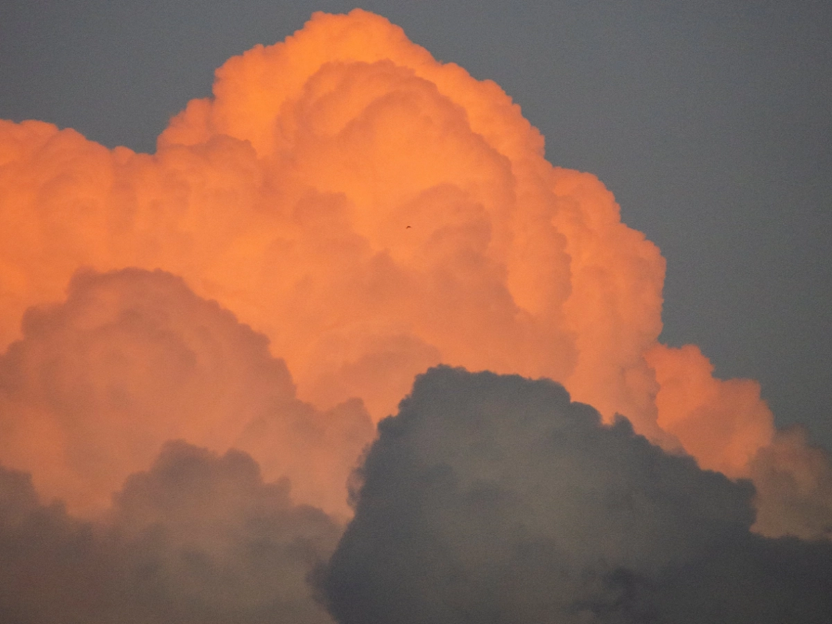
Nimbus Clouds
A nimbus cloud is the ominously dark cloud form that signals coming rain, and sends us scurrying for shelter as they approach. Characteristicaly dark due to the massive quantity of water that they carry within them, a Nimbus cloud is a sign of an imminent precipitation. Nimbus often arrive in union with other cloud forms. Together they bring the substantial precipitation adequate to form the impressive heights of the cumulonimus, and the wide spread often seen in nimbostratus clouds.

What Is A Nimbus Cloud?
Nimbus clouds belong to the types of clouds with the Latin moniker ‘nimbo-‘ meaning rain. These clouds are the chariots of precipitation, bringing rain, snow, sleet, or hail to the Earth below. Nimbus clouds are primarily of two types: nimbostratus and cumulonimbus.
Nimbostratus Clouds:
These clouds are the gentle giants of precipitation, spreading a thick, gray blanket across the sky. Nimbus clouds often form at mid-level altitudes, typically between 2,000 to 7,000 meters (6,500 to 23,000 feet). Their expansive layers bring prolonged periods of precipitation.
Cumulonimbus Clouds
In contrast to the slow and steady grown-up nimbostratus clouds, the sudden drama and rapid passing of cumulonimbus clouds make them the dramatic teenagers of the skies. Soaring to towering heights of up to 20 kilometers (65,000 feet), cumulonimbus clouds are veritable skyscrapers of the atmosphere. These colossal clouds are the epitome of instability, harboring intense updrafts and downdrafts that spawn thunderstorms, lightning, and even tornadoes.
Indentifying Nimbus Clouds
Nimbostratus

Nimbus clouds bear visual and atmospheric characteristics that differentiate them from other cloud genera, namely their darkness, and the precipitation this darkness signifies. Nimbostratus clouds present a continuous, extensive, and opaque layer across the sky.
Their uniform gray appearance lacks the distinct puffiness of cumulus clouds or the wispy elegance of cirrus clouds. Nimbostratus often herald prolonged periods of precipitation, and their moisture-laden demeanor creates a subdued, overcast sky.
Cumulonimbus
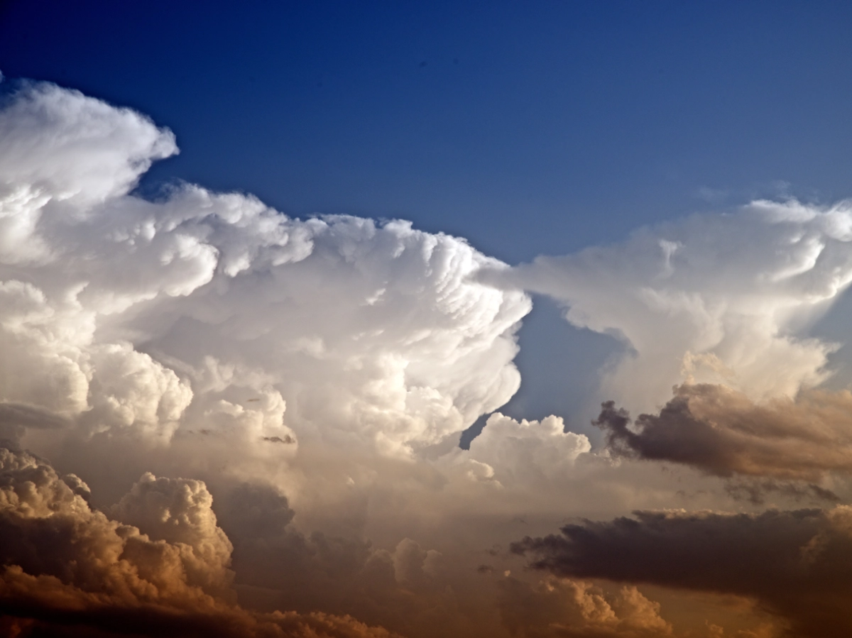
Cumulonimbus clouds, on the other hand, with their towering piles of dramatically dark, dense, billowing formations, are unmistakably distinct. These clouds exhibit a vertical development that distinguishes them from their stratiform counterparts.
With a massive, towering structure, cumulonimbus clouds often penetrate into the troposphere, displaying a well-defined anvil or mushroom-shaped top. This structural complexity contrasts sharply with the more horizontal and featureless nature of nimbostratus clouds. Cumulonimbus clouds associated with intense weather events.
Nimbus Cloud Formation and Lifecycle
Nimbostratus formation
Nimbostratus clouds take shape through a complex interplay of atmospheric conditions. Typically, these clouds form in the middle-altitude range, situated between 2,000 and 7,000 meters (6,500 to 23,000 feet). The genesis of nimbostratus clouds often occurs along frontal boundaries, where two air masses with differing temperatures and moisture content converge. As a warm, moist air mass ascends over a colder, denser one, the warm air cools and condenses, leading to the development of a broad and continuous layer of nimbostratus clouds.
Unlike the dynamic updrafts associated with towering cumulus clouds, nimbostratus clouds are characterized by a more gradual lifting of air, fostering the creation of an expansive, featureless overcast. The resulting cloud layer effectively shields the sun, casting a diffuse and muted light over the landscape. This gradual lifting and cooling process, driven by frontal interactions, establishes nimbostratus clouds as the heralds of extended periods of steady precipitation, be it rain or snow.
Cumulonimbus formation
Cumulonimbus are formed when cumulus clouds are buoyed by vigorous updrafts. Lifted by this warm moist air, they ascend through the troposphere until they encounter the tropopause. At this boundary, the clouds’ upward growth is stifled, leading to a sprawling anvil-shaped crown characteristic of cumulonimbus clouds. Intense updrafts persist, lifting moist air and facilitating the condensation of water vapor into droplets or ice crystals. This continual vertical ascent results in a robust, vertically developed structure with a turbulent base, heralding the potential for thunderstorms, lightning, heavy rainfall, hail, and even tornadoes.
No Nimbus, No Life
Nimbus clouds are crucial components of Earth’s hydrological cycle, playing a central role in the distribution of water. These clouds, especially nimbostratus and cumulonimbus types, facilitate the condensation and precipitation of water vapor. As nimbus clouds release rain or snow, they contribute to surface water sources, groundwater recharge, and soil moisture. This precipitation sustains agriculture, supports ecosystems, and ensures the availability of freshwater resources. Additionally, nimbus clouds influence temperature regulation, impacting local climates and weather patterns. In essence, nimbus clouds are vital agents that contribute to the overall health and balance of Earth’s ecosystems.
Know Nimbus, Know Life
In large part because of this impoprtance, meteorologists use nimbus clouds as significant indicators in weather forecasting, drawing essential insights from their characteristics. By observing their presence, extent, and structure, meteorologists can infer information about impending weather conditions. Ground-based and satellite-based radar systems are instrumental in monitoring the dynamics of nimbus clouds, aiding in predicting the onset, intensity, and duration of precipitation in a given area. The analysis of nimbus clouds also contributes to understanding broader atmospheric patterns, such as the presence of weather fronts and the potential for atmospheric disturbances. In essence, nimbus clouds serve as meteorological cues, providing valuable data that enhances the accuracy of weather forecasts and helps meteorologists anticipate and respond to changing atmospheric conditions.
Conclusion
The nimbus cloud, in all its meteorological glory, serves as a reminder of the intricate dance between Earth and sky. From the gentle embrace of nimbostratus to the tempestuous theatrics of cumulonimbus, these clouds command our attention, shaping the weather and the landscapes below. So, the next time nimbus clouds gather on the horizon, take a moment to appreciate the atmospheric drama unfolding above—a spectacle painted by the ethereal brushstrokes of water vapor, temperature differentials, and the ceaseless choreography of our dynamic atmosphere.
Because a nimbus cloud can signal an approaching storm, they’re a cloud formation you want to pay close attention. In order to prepare and react appropriately, to ensure the safety of you and others, check for forecasts and alerts with your regional weather service.
Frequently Asked Questions
Answer: Nimbus clouds are a type of cloud associated with precipitation. They include nimbostratus, known for continuous rain or snow, and cumulonimbus, which can bring thunderstorms and severe weather.
Answer: Nimbostratus clouds often form along frontal boundaries, where moist air rises over colder air. Cumulonimbus clouds develop from mature cumulus clouds, growing vertically and often reaching the tropopause.
Answer: Nimbus clouds, especially nimbostratus, bring continuous and steady precipitation. Cumulonimbus clouds can lead to thunderstorms, lightning, heavy rain, hail, and occasionally tornadoes.
Answer: Nimbostratus clouds have a uniform, overcast appearance without distinct vertical development. Cumulonimbus clouds, in contrast, exhibit towering structures and often have an anvil-shaped top.
Answer: Nimbus clouds are essential to the water cycle, facilitating the transformation of water vapor into precipitation. This process contributes to the replenishment of water sources, groundwater, and soil moisture.
Answer: Meteorologists monitor nimbus clouds using instruments like radar and satellite imagery. The presence and characteristics of nimbus clouds provide valuable information for predicting rainfall, severe weather events, and overall atmospheric conditions.
Nimbus Cloud Image Gallery